Richard Lutz takes to the air and witnesses the deluge.
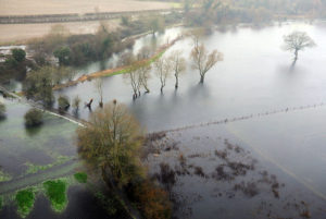
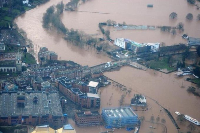
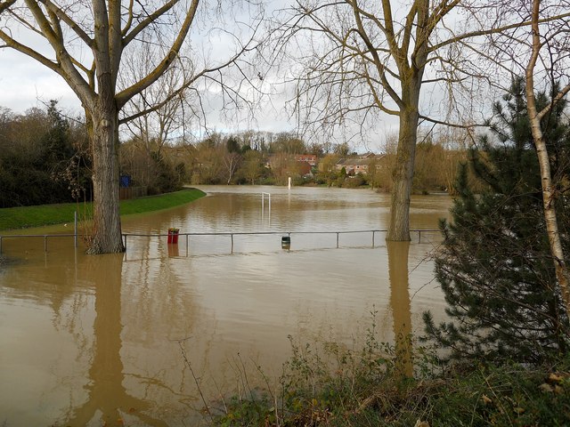
“I’ve never seen it like this,” Jerry says as he flies his plane over the submerged Severn Valley. It’s flooded, a river churning south from the Welsh Hills to the estuary and spreading out like a sloppy fantail across the sodden terrain. It swooshes through Shrewsbury, Ironbridge, Bewdley and then spreads over the Worcestershire floodplain. It invades and seeps into towns, drowns roads, stops the world.
Where the Severn meets the Avon, nearby Tewkesbury Abbey is surrounded on three sides by brown muddy water. The river junction is a messy lake.
Nearby, the M5 roars past and, shockingly, the floodwaters are about only 200 metres from the motorway. From our Piper Turbo Arrow, about 1,800 feet above the wet terrain, we see cars speeding north and south, seemingly oblivious how close they are to a riverine spill.
We are flying about 120mph and buffeted by 35 mph winds. So, as we dip towards a wet Worcester with its submerged race course, we jolt and bump. It convinces you quite sharply that you’re in a souped-up metal can.
We head south towards The Cotswolds. They’re a rumpled wall of hills and, overhead, brooding clouds are ready to spill onto the river, adding more rain to the sodden ground. To the west are the Malverns, resembling a sleeping humped animal. We head away from the impending storm and fly east.
East is drier. The Severn Valley may never have been as wet and boggy but south Warwickshire and the East Midlands landscape is mainly clear of flooding and mud, maybe because it gently rises.
The land is a quilt of brown and pale green, dotted with tidy farmhouses, discreet posh homes with stables and little compact villages that are linked by sinewy roads. It is middle England.
 Jerry continually points down to old RAF bases that are squeezed, it seems, in the triangle between the Cotswolds, The Severn and Coventry. He counts nine former military airfields, some abandoned, some only memories, some still in use by light aircraft…Honeybourne, Defford, Long Marston, Wellesbourne, Pershore….the names all sound faintly familiar. Didn’t Uncle Mervyn train as a bomber navigator at Pershore? Wasn’t Long Marston the meeting point for a huge raucous bikers’ hoe-down for a while? Didn’t Gaydon turn into a British Leyland test track? Britain forgets quickly.
I was invited into the sky and saw the Midlands drenched to the bone on the floodplain. But so much is untouched, it seems, by the wet weather. Even so, the Avon, twisting through Stratford, spreads out as it leaves the town and begins to meet its sister, the Severn.
It bursts its banks so often that the ends of its oxbow loops meet and it looks as if another storm, a big storm, could link the two rivers with a single huge floodplain lake, bigger than anyone has seen. It’s that wet. It’s that sodden.


what a ride !!
Helicopter would have been better than our end to end walk last week
Powerfully descriptive. Thank you Mr Lutz!
You should have flown over Herefordshire – we have some doozy of a flood
I am surprised there are’t more graphs around showing data for long term trends of rainfall.
This one below seems to show great fluctuations in rainfall for January each year, but no upward trend.
But I would like to see a long term series based on full years [not just individual months]
There must be some info somewhere, its an obvious thing to look at.
https://www.metoffice.gov.uk/research/climate/maps-and-data/uk-temperature-rainfall-and-sunshine-time-series
I hadn’t known about the floods. Hope the waters are receding.